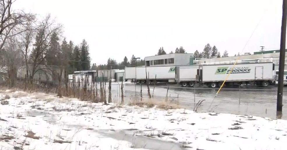
Local school districts on emergency bus route service Monday | Spokane News

...The National Weather Service in Spokane WA has issued a Flood
Warning for the following rivers in Washington...

Hangman/Latah Creek at Spokane affecting Spokane County.

.Heavy rain will fall on a deep primed snowpack leading to the melt
increasing. Flows in rivers will increase quickly.

For the Hangman/Latah Creek ...including Spokane...Minor flooding is
forecast.

PRECAUTIONARY/PREPAREDNESS ACTIONS...

Motorists should not attempt to drive around barricades or drive
cars through flooded areas.

Additional information is available at www.weather.gov.

The next statement will be issued late tonight at 545 AM PST.

&&

...FLOOD WARNING IN EFFECT FROM LATE TONIGHT TO LATE TOMORROW
EVENING...

* WHAT...Minor flooding is forecast.

* WHERE...Hangman/Latah Creek at Spokane.

* WHEN...From late tonight to late tomorrow evening.

* IMPACTS...At 11.0 feet, Minor flooding of low lying areas and
roads adjacent to the stream is possible.

* ADDITIONAL DETAILS...
- At 4:45 PM PST Sunday the stage was 9.9 feet.
- Bankfull stage is 10.0 feet.
- Forecast...The river is expected to rise above flood stage
just after midnight tonight to a crest of 11.2 feet late
tomorrow morning. It will then fall below flood stage early
tomorrow afternoon.
- Flood stage is 11.0 feet.
- Flood History...This crest compares to a previous crest of
11.2 feet on 02/27/1957 and 11.02 feet on 12/28/1998.
-

&&
...FLOOD ADVISORY REMAINS IN EFFECT UNTIL 7 AM PST TUESDAY...

* WHAT...Flooding caused by rain and snowmelt continues.

* WHERE...Portions of Idaho, including the following counties,
Bonner, Boundary, Kootenai, Lewis, Nez Perce and Shoshone and
Washington, including the following counties, Asotin, Garfield and
Spokane.

* WHEN...Until 700 AM PST Tuesday.

* IMPACTS...Minor flooding in low-lying and poor drainage areas.
Water over roadways. Ponding of water in urban or other areas is
occurring or is imminent. A storm spotter reported field flooding
with over an inch of rain northeast of Sandpoint, ID.

* ADDITIONAL DETAILS...
- At 428 PM PST, Numerous reports from the public, storm
spotters, and highway roads department indicated ponding of
water over roads, field flooding, and flooding of low lying
areas with poor drainage.
- Some locations that will experience flooding include...
Spokane, Spokane Valley, Coeur d'Alene, Lewiston, Post Falls,
Hayden, Cheney, Sandpoint, Clarkston, Rathdrum, Bonners
Ferry, Dalton Gardens, Kellogg, Priest River, Pinehurst,
Osburn, Lapwai, Wallace, Liberty Lake and Airway Heights.
-

PRECAUTIONARY/PREPAREDNESS ACTIONS...

Be aware of your surroundings and do not drive on flooded roads.

Please report observed flooding to local emergency services or law
enforcement and request they pass this information to the National
Weather Service when you can do so safely.

&&
link


